



Monitoring of the Environmental Protection Agency directly fulfills the objectives of the State Program for the Remediation of Environmental Burdens. Its main purpose is:
- Health protection: Reducing the risk of contaminated water and soil for people in the vicinity of the loads.
- Clean water: Fulfilling EU directives and achieving good water status in Slovakia.
- Stopping the spread of pollution: Stopping contamination clouds and reversing negative trends.
- Information: Better overview of risks for the public and entrepreneurs.
How is the preparation going? monitoring?
The monitoring itself is always preceded by the development of a precise plan for each location.
-
The plans determine the scope of field measurements, sampling and laboratory work.
-
The design takes into account the points of pollution leakage and the direction of groundwater or surface water flow.
-
Checkpoint: At least one monitoring object is always located in an unaffected area to know the natural (background) properties of the environment.
-
Regular update: We review and adjust the plans every year based on the latest results.
How do we evaluate the results?
Groundwater
The assessment is carried out according to the Directive of the Ministry of the Environment of the Slovak Republic No. 1/2015 – 7 (Risk analysis of polluted areas). It follows two key limits:
⚠️ Indicator criterion (ID): Threshold value. Exceeding it may endanger health or nature and signals the need for further monitoring of the area.
🚨 Intervention criterion (IT): Critical value. High probability of endangering health and the environment. If it is exceeded, it is necessary to launch a detailed geological survey and risk analysis.
Surface waters
We assess the results according to Government Regulation No. 269/2010, which clearly defines the requirements for achieving good water status.
Map outputs and evaluation
Are you interested in the current status in your area or are you looking for detailed data? Use our online tools and reports:
-
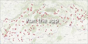
Map of environmental loads monitored by ŠGÚDŠ
View the location and details of monitored objects directly on a clear interactive map.
-
Informative evaluation of the results of the EZ monitoring
[ View evaluation ]
Complete overview and analysis of the measured results carried out by experts from the Dionýz Štúr State Geological Institute.