



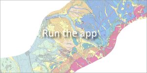
 Editor: Ján Madarás | Map scale: 1 : 25,000 | Year of publication: 2014
The web application is spread over the wider hinterland of the capital city of Bratislava, which is among the most visited tourist areas of the country. The Geopark is characterized by an extremely diverse geological structure in a relatively small area, which is reflected in the diversity of relief forms and beautiful landscape scenery.
In addition to a detailed explanation of the geological structure, the platform provides information about the natural beauties of the region, tourist attractions and significant mineralogical occurrences.
🌲 Nature protection and geography
The Geopark is located in the Bratislava Self-Governing Region (it extends into the districts of Bratislava IV, Malacky and Pezinok) and includes areas with the highest natural value:
-
ChKO Malé Karpaty
-
ChKO Záhorie (selected parts)
-
ChKO Dunajské luhy (selected parts) parts)
📍 List of information boards and educational points
The following locations are equipped with information boards. The coordinates and altitudes will help you plan your route:
| Name of the information board | GPS coordinates | Altitude |
| SAPAG – introductory information board | 48°12’05.89″N, 16°58’16.11″E | 150 m |
| Abrazna cave, bralo Slovinec | 48°12’05.83″N, 16°58’16.13″E | 150 m |
| Geology of Devínská Kobyla, Sandberg | 48°12’03.49″N, 16°58’25.49″E | 195 m |
| Wait’s quarry and historical quarries on Devínská Mare | 48°11’39.98″N, 16°58’44.83″E | 200 m |
| Devín castle hill | 48°10’28.13″N, 16°58’36.69″E | 145 m |
| Quaternary geology of Moravia and Danube | 48°12’40.10″N, 16°58’06.91″E | 145 m |
| Marianka – Slate Tunnel | 48°14’51.73″N, 17°04’01.39″E | 230 m |
| Pajštú Castle Rampart | 48°16’31.93″N, 17°04’56.80″E | 465 m |
| Borinka (Pod Zámčiskom) – mining of Mn ores | 48°15’20.56″N, 17°06’32.04″E | 320 m |
| Borinský karst: Limbašská vieráčka | 48°17’41.04″N, 17°10’10.81″E | 340 m |
📅 About the application
Application launch: 06/2014