



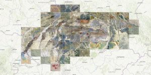
The Imperial-Royal Reich Geological Institute in Vienna began its activities on December 1, 1849. One of the first tasks was a geological survey and the compilation of a geological map of the entire Austro-Hungarian Monarchy.
In the years 1860 to 1880, significant political events occurred in the country for the institute. In 1861, the Ministry of Trade and Economy was formed, whose program included, among other things, the mining industry, with which the entire activity of the institute was very closely related.
The first and most important task of the institute consisted of extensive geological mapping. A collective of workers led by 6 permanent geologists compiled the first clear maps after 14 years, even though the plan counted on up to 30 years.
In 1873, the Military Geographical Institute published a new topographical special map in M 1: 75,000 for the entire monarchy, which was used as a basis for the creation of a more accurate geological map under the leadership of Franz von Hauer and subsequently Dionýz Štúr. The first maps were handwritten, which at the time had advantages (continuous updates, changes), but also disadvantages (slowness and high price). By 1900, the institute compiled more than 5,200 hand-colored map sheets to order. The goal was to publish map sheets in color printing, which began under the leadership of director Dionýz Štúr. Because color printing was very expensive, only part of the map sheets were selected for each new edition.