



 Gravimetry, as a part of applied geophysics, measures and evaluates the gravitational acceleration of the Earth’s gravitational field. The measured values are used to determine density inhomogeneities in the earth’s crust.
Practical use of gravimetry:
-
Searching for subsurface cavities.
-
Solving problems in petroleum geophysics and hydrogeology.
-
Application in environmental and deposit geology.
-
Research of any structures that create a density-different anomaly.
📊 Scope of processed data
The portal provides access to the results of an extensive geological task, within which all regional gravimetric measurements were comprehensively unified (at a scale of 1 : 25,000).
-
Number of measurement points: almost 212,500 points were reassessed of the entire territory of the Slovak Republic.
-
Database: created on the basis of a modern geophysical information system.
🗺️ Map outputs
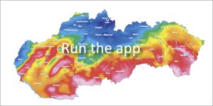
Two basic full-area maps are available in the application:
-
Map of complete Bouguer anomalies (UBA)
-
Map of residual gravity anomalies (RTA)
In addition, purpose-derived gravity maps and density model compiled along regional gravity profiles across the Western Carpathians are available for selected areas of the Slovak Republic.
📅 About the application
Application Launch: 04/2009
Last Updated: 04/2013