



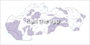
 This application displays areas covered by detailed hydrogeochemical maps at a scale of 1:50,000. Their primary purpose is to clearly illustrate the most important qualitative and geochemical characteristics of groundwater in the first aquifer (or in other significant aquifers). horizons).
Main map criteria (area display)
-
Qualitative criterion: The specific groundwater quality class is expressed on the map by color fill.
-
Geochemical criterion: Individual geochemical groups of groundwater are shown by pattern fill (hatching/texture).
-
Water management criterion: Areas are marked with outlines according to the class of water use and treatment they belong to.
Point elements
Point markers on the map represent precise sampling locations of groundwater. After clicking on the given point, you will get detailed information about the chemical composition of the water, as well as its overall geochemical and qualitative assessment.
Methodological procedures and guidelines
The creation and digitization of these maps is strictly subject to the official standards of the Ministry of the Environment of the Slovak Republic:
-
Directive of the Ministry of the Environment of the Slovak Republic No. 8/2004-7 on the compilation of basic hydrogeological maps.
-
Directive of the Ministry of the Environment of the Slovak Republic No. 9/2004-7 on the compilation of basic hydrogeochemical maps.
-
Directive of the Ministry of the Environment of the Slovak Republic No. 2/2000 on the principles of processing and presenting project results in geographic information systems (GIS).
📅 About the application
Application launch: 04/2008
Last update: 01/2025
Expert Advisor:
-
RNDr. Peter Malík, PhD.
-
📞 Tel.: 02/593 75 416
-
📧 E-mail: peter.malik[at]geology.sk