



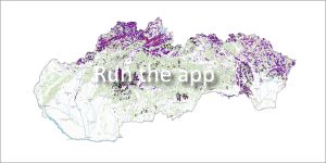
 The application provides a reliable spatial overview of registered and documented slope deformations throughout the Slovak Republic. It serves as an important basis for spatial planning, construction activities and natural hazard prevention.
What does the application display?
The application maps dangerous slope phenomena and divides them into two basic categories:
-
Point landslides – capture slope deformations of a smaller scale.
-
Area landslides – delimit larger areas affected landslide activity.
Data origin and link to the Geofond Archive
The available digital layers were compiled based on two main pillars of geological research in the Slovak Republic:
-
Results of the complex project Atlas of slope stability maps of the Slovak Republic at a scale of 1:50,000 (Šimeková J. et al.), which was successfully completed in 2006.
-
Current data from the official Geofond Landslide Register.
📄 Access to final reports
The attribute table of each displayed landslide contains a direct link to the corresponding final report stored in the Geofond Archive. Registered users of the portal have the opportunity to fully view these documents via remote access.
📅 About the application
Application launch: 04/2010
Registry administrator:
- SGIDŠ Geofond
-
📧 E-mail: geofond@geology.sk