



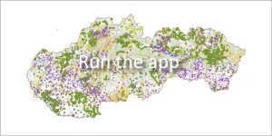
 The application provides a detailed spatial overview and point records of registered waste landfills in the Slovak Republic. It serves as an important information source for public administration, the professional public and citizens in the field of environmental management.
What does the landfill database contain?
Each registered landfill is characterized by an extensive set of information. Users will find data in the system about:
-
Location and surroundings: Topographical situation and relationship to the surrounding biosphere.
-
Natural conditions: Detailed geological and hydrogeological characteristics of the subsoil.
-
Technical parameters: Technical characteristics of the landfill, its territorial significance and waste composition.
-
Operation and condition: Information about the operator, method of use, current condition, monitoring system and proposal for further use after the end of operation.
Data origin and regular update
-
History project: The foundations of the database began to be systematically built in 1992 as part of the nationwide project “Maps of Landfill Suitability at a Scale of 1:50,000” (implemented by the Slovak Geological Survey). It included detailed registration of landfills at the district level at a detailed scale of 1:10,000.
-
Annual update cycle: Data is regularly updated based on changes detected directly in the field (e.g. landfill expansion, volume change, closure). The update is carried out annually through reports from environmental protection department workers or direct registration by authorized users.
Link to the Geofond Archive and the EZ Information System
📄 Access to final reports
In the attribution tables of individual landfills there is a direct link to the expert final reports stored in the Geofond Archive. Registered users have remote access to these documents.
-
Environmental burdens: The application also includes a specialized layer of environmental burdens, which was processed based on expert final reports from Geofond.
-
Integration with SAŽP: The Landfill Registry is fully connected to the Environmental Burden Information System (IS EZ), which is operated by the Slovak Environmental Agency. This connection works on the basis of international OGC standards and ESRI ArcGIS technologies with support for REST and SOAP web interfaces.
📅 About the application
Application launch: 04/2010
Data update: It is carried out online or operationally as needed.
Registry administrator:
- SGIDŠ Geofond
- 📧 E-mail: geofond@geology.sk