



 Geoelectrical survey methods investigate the stationary electric field of the Earth and the area of non-stationary electromagnetic fields, including the reactions of the geological environment to them.
Main survey outputs:
-
Classification of rocks according to their electrical resistivity.
-
Mapping areas with anomalous induction effects.
-
Localization of zones with accumulation of electric charge in the rock environment.
Given the number of sources of electromagnetic fields, there is a large number of geoelectric methods – probably the most among all geophysical disciplines.
Vertical electrical sounding (VES)
One of the most widely used methods is vertical electrical sounding (VES). It is used to detect changes in the electrical resistivity of the rock environment into the depth.
-
Implementation: Measurements are taken along profiles. The distance of the electrode system is selected according to the required depth range.
-
Use: The method is ideal for identifying (sub)horizontal interfaces of geological layers.
📊 Data and statistics in the GeoIS system
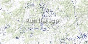
The GeoIS portal provides an object-oriented information system that contains a set of relevant data and documents from VES measurements from the entire territory of the Slovak Republic.
- Scope of the database: A total of 18,167 individual data have been processed, reviewed and made available VES measurements.
- Additional information: The selected measurements also include archived data important for the interpretation or reinterpretation of the geological structure of the areas of interest.
- Benefit for practice: The data are mainly used to determine the thickness and lithological character of Quaternary and partly Neogene sediments.
📅 About the application
Application launch: 04/2009
Last update: 04/2014