



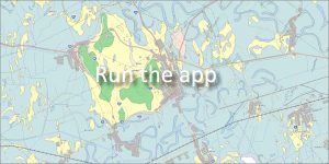
 Authors: Kobulský, J., Gazdačko, Ľ., Žecová, K., Maglay, J., Bačo, J., Bačová, P. | Scale: 1 : 50,000 | Year of publication: 2014
The web application provides a professional interpretation of the geological structure of the area and also serves as a comprehensive guide to the wildlife, tourist attractions and rich historical development of the former Zemplín County.
🗺️ Geographical location and correct division
The Zemplín Hills are located in the southern part of eastern Slovakia. The entire area of interest of the map work extends in the Košice Self-Governing Region and extends into two districts:
-
Trebišov District
-
Michalovce District
🌲 A rich network of protected areas
The geological subsoil in this area creates conditions for unique ecosystems. The territory is protected within the CHKO Latorica and includes an extensive network of small-scale protected sites:
-
National Nature Reserves (NPR): Botiansky luh, Kašvár, Latorický luh.
-
Nature Reserves (PR): Biele jazero, Boľské rašelinisko, Dlhé Tice, Horešské lúky, Krátke Tice, Poniklecová lúčka, Raškovský luh, Tarbucka, Veľké jazero, Zatínsky luh, Zemplínska jelšina.
-
Protected areas (CHA): Bešiansky polder, Boršiansky les, Oborínske jamy, Veľký kopec.
🇪🇺 European significance: Natura 2000 system
A large part of the region falls under international habitat protection. Integrated sites include, for example:
Bešiansky polder, Bodrog, Boršiansky lesík, Čičarovský les, Horešské lúky, Kováčské lúky, Ladmovské vápence, Latorica, Oborínske jamy, Oborínsky les, Raškovský luh, Tarbucka and Veľký kopec.
💡 A useful tool for working with the map: For detailed information about individual geological features objects and protected areas can be easily accessed in the application – by clicking directly on the map in the pop-up window.
Useful link:
👉 [ The Zemplín Hills Region from the Perspective of Geology and Tourism (PDF) ]
📅 About the application
Application launch: 11/2016