




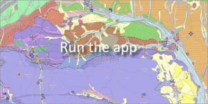
 Authors: Gazdačko, Ľ., Németh, Z., Žecová, K., Stercz, M., Kronome, B., Lenhardtová, E., Maglay, J., Košuth, M. | Scale: 1 : 50,000 | Year of publication: 2021
In addition to a detailed interpretation of the geological structure of the region, the application provides rich information about tourist attractions and unique natural resources.
⛏️ A landscape shaped by centuries of mining
The goal of this map is to raise awareness of the rich history and uniqueness of the depicted landscape. The region serves as a significant example for explaining geological processes, tectonic settings, and the origin of mineral deposits.
Mining activity is still clearly present here today. In the field, it is documented by:
-
Mining relics: Remains of exploration trenches, abandoned adit tunnels and traces of surface mining of ore veins.
-
Technical monuments: Remains of mining equipment, shafts and original mining buildings.
-
Cultural heritage: The mining tradition is still commemorated by the heraldic symbols of towns and villages, in which crossed mining hammers often dominate the coats of arms.
🗺️ Geographical location and territorial division
The Medzev – Jasov region is located in the southern part of eastern Slovakia. The territory extends in the Košice Self-Governing Region and extends into three districts:
-
Košice-surroundings District
-
Gelnica District
-
Rožňava District
🌲 National parks and protected areas
The diverse geological subsoil determines the high species diversity. The territory includes the PLKO Slovenský kras and a network of small-scale protected areas:
-
National Nature Reserves (NPR): Havrania skala, Jasovské dubiny, Turniansky hradný vrch, Zádielska tiesňava.
-
Nature Reserves (NR): Kloptaň, Palanta, Zemné hradisko.
📅 About the application
Application launch: 11/2021