



 Authors: Franko, O., Remšík, A., Fendek, M. et al. | Year of publication: 1995
Data format: Interactive vector map layers + accompanying PDF (scale and legend)
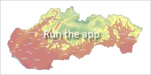
The atlas presents a comprehensive summary of results from more than two decades of geothermal and hydrogeological research in territory of Slovakia, building on the foundations laid by 1970. It interprets the spatial distribution of geothermal activity by combining level maps, pre-Tertiary bedrock maps and heat flux density maps.
🌐 Cartographic display and scales
The application works with two levels of detail:
-
Overview level (1:1,000,000): Displays geothermal activity and heat flow density for the entire territory of Slovakia.
-
Detailed level (1:200,000 and more detailed): Captures detailed status and anomalies in selected, prospective geothermal areas.
🔍 Depth map layers (Vector model)
Geothermal activity is represented by a set of 14 vector maps. Geothermal area maps are organized into separate data layers for GIS analysis purposes according to the following depth levels:
📍 Available depth horizons in the web application:
500 m • 1,000 m • 1,500 m • 2,000 m • 2,500 m • 3,000 m • 4,000 m • 5,000 m
📂 Atlas documents for download
📖 Ccitation of the work:
FRANKO, O. – REMŠÍK, A. – FENDEK, M. et al.: Atlas of Geothermal Energy of Slovakia [online]. Bratislava: Dionýz Štúr State Geological Institute, 2010. Available online: https://app.geology.sk/atlasge.
📅 About the application
Application launch: 04/2010
Last update: 01/2017