



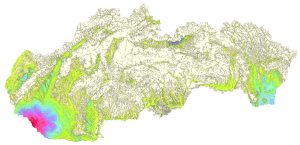
Geological Map of the Quaternary of Slovakia – Map of Quaternary Deposits Thickness, Maglay, J. et al., 2009, scale 1:500,000
For the first time at this scale and within this conceptual scope, the map provides a qualitative and areal assessment of the thickness of Quaternary deposits in the Western Carpathians and the Pannonian Basin within Slovakia. In relation to the individual genetic types depicted on the map of Quaternary deposit genetic types, the thickness map illustrates the resulting structuring of the Quaternary cycle of geodynamic evolution in Slovakia. Its main content consists of isolines of Quaternary deposit thickness depicted in corresponding depth intervals, graded by color. The depth intervals are graded to reflect as accurately as possible the neotectonic conditions of the territory and the vertical movement trends of the individual structural-tectonic blocks shown in the accompanying diagram.