



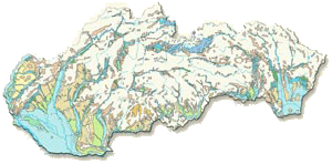
| 1. Quaternary Deposits, Maglay, J. and Pristaš, J., scale 1 : 1,000,000, The Landscape Atlas of the Slovak Republic, 2002 Compared to earlier periods of geologic history of the Earth the Quaternary is the youngest and the shortest period of time (2.4 mil. years), which continues to this day. Current knowledge about the spatial distribution of basic genetic types of Quaternary sediments in Slovakia comes from the latest results of the regional geological mapping. |
 |
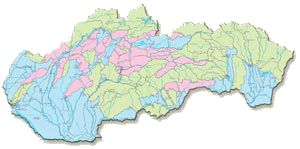
| 2. Principal Hydrogeological Regions, Malík, P. and Švasta, J., scale 1 : 1,000,000, The Landscape Atlas of the Slovak Republic, 2002 Principal hydrogeological regions, shown on the map, respond to the distribution of main water balancing units – “hydrogeological rayons” – delineated by Šuba et al. (1995). These are depicted, using different colours, according to the dominating rock permeability type in the regions: intergranular (porous), fissure or karst-fissure types. Number of the hydrogeological region, shown on the map, is linked to the “hydrogeological rayon identifier”, as maintained, balanced and reported from the groundwater usage point of view by the Slovak Hydrometeorological Institute. |
 |
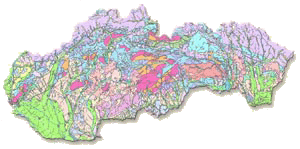
| 3. Engineering-Geological Zoning Map, Hrašna, M. and Klukanová, A., scale 1 : 500,000, The Landscape Atlas of the Slovak Republic, 2002 The engineering-geological zones are delimited relying on the genesis and lithological nature of the rocks. The zones of the Quaternary and pre-Quaternary rocks are discerned. If two Quaternary lithological complexes appear one above another and the thickness of the surface complex is below 5 meters, combined regions are delimited while their name and symbol express both types of complexes. The regions delimited on the schematic map respond to the basis geological-tectonic units of the Western Carpathians, subregions are delimited partly by the same principles as the regions and partly by the specific features of the lithological building of the rock environment. The delimited territorial units of zoning make it possible to assess the suitability of the rock environment with regard to the different economic land use at the given level of details. |
 |
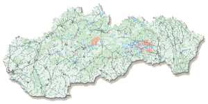
| 4. Soil Contamination, Čurlík, J. and Ševčík, P., scale 1 : 500,000, The Landscape Atlas of the Slovak Republic, 2002 Inorganic soil contamination is expressed by the intersection of the sets of contents of risk elements exceeding the threshold values. It was compiled from the mono-element geochemical maps made by application of geostatistical methods based on the results of 5,189 chemical analyses of forest and agricultural soils. The density of soil sampling was 1 sample per 10 square kilometres in average. Point and diffuse soil contamination according to the limits in force (Decision of the Ministry of Agriculture of the SR No. 531/1994-540) is represented on the map. The extent of the areas with relatively clean soils and the areas with higher background concentration of elements in soil is obvious. The spreading of the limit exceeding contents of risk elements is related to the geochemical, but above all anthropogenically produced, contamination sources in the areas of old mining, processing and metallurgical factories (Central Slovakia and the Spiš-Gemer area). It also indicates the transfer of contaminants into the alluvial zones of rivers and brooks. |
 |
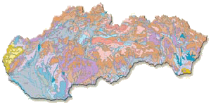
| 5. Soil Susceptibility to Acidification, Čurlík, J., scale 1 : 1,000,000, The Landscape Atlas of the Slovak Republic, 2002 The capacity of soils to resist to acidification depends on the content of carbonates, humus, clayey minerals, and salts. The least prone to acidification are the carbonate and alkaline soils where the pH does not significantly change (the carbonate controlling system). The soils pertaining to different soil units (carbonate Chernozems, Histi-Mollic Gleysols, Fluvisols, Rendzinas, Solonchals and Solonetzs) are in this group. On the other side, there are the very washed out (leached) soils of mountain areas where pH does not change significantly due to their extreme acidity (aluminium controlling system). Four classes of soils with different susceptibility to acidification depending on their buffer capacities controlled by the content of clay, humus and basic ions are classified into this group. Very sensitive (prone to acidification) are the light sandy soils with low content of humus and clay where pH in slightly acid to neutral areas is maintained by calcification and fertilisation. |
 |
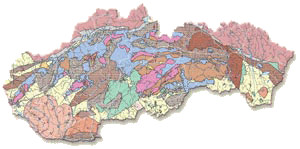
| 6. Geothermal and Mineral Water Sources, Fendek, M. et al., scale 1 : 500,000, The Landscape Atlas of the Slovak Republic, 2002 On the basis of distribution of the collectors of geothermal energy resources and geothermal field activity, 26 perspective areas or structures suitable for exploitation and energetic use were identified in Slovakia. They include above all the Tertiary basins or intra-mountain depressions spread in the zone of the Inner Western Carpathians. Their total area represents 34 % of Slovakia’s territory. The sources of geothermal energy are represented in Slovakia above all by geothermal waters, which are linked to the Triassic dolomite and limestone rocks of the Inner Carpathian tectonic units, and in less extent to the Neogene sands, sandstone rocks, conglomerates or to the Neogene andesite rocks and their pyroclastics. These rocks as collectors of geothermal waters are situated in the depth of 200 – 5,000 m and contain the geothermal waters with temperature 20 – 24 °C. The overall thermal-energetic potential of the geothermal waters of Slovakia represents 5,538 MWt, out of which 4,985 MWt is attributable to the reserves and 553 MWt to the sources. Probes carried out so far confirmed about 1,200 l.s-1 of geothermal waters, the thermal performance of which represents around 270 MWt. More than 1,600 sources of mineral waters linked to all geological and tectonic units occur in the territory of Slovakia. Their minimal yield often does not surpass thousandths or hundredths of l.s-1. Maximum yield though, reaches tens l.s-1 but mostly 50 l.s-1. The minimum temperatures of mineral waters start at the level of the average annual air temperature of the locality and the maximum temperatures seldom exceed 70 °C. |
 |
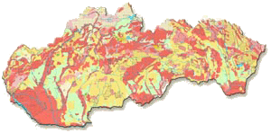
| 7. Suitability of territory for waste deposition, Klukanová A. and Iglárová, Ľ., scale 1 : 1,000,000, The Landscape Atlas of the Slovak Republic, 2002 The map is based on the maps of suitability of waste disposal at scale 1 : 50 000 compiled at the State Geological Institute of Dionýz Štúr. The map divides the territory to suitable, conditionally suitable, and unsuitable. The following factors were assessed: protected water-economic territories, sources of underground waters, protected natural territories, protected forests, mineral deposits, structural arrangement of rock environment with regard to the degree of threat to underground water, geodynamic phenomena, and hydrogeological characteristics. |
 |
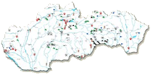
| 8. Important geological sites, Liščák, P. et al., scale, 1 : 1,000,000, The Landscape Atlas of the Slovak Republic, 2002 Slovakia has 174 geological sites of interest. Some localities are protected in the sense of the Act of the National Council of the SR No. 287/1994 of Coll. on nature and landscape protection under the highest, fifth level of protection as national natural monuments, natural monuments, national natural reserves or natural reserves, other are protected pursuing the Convention on protection of the world cultural and natural heritage. The majority of stratigraphic and palaeontological localities are not protected by the law, but they are extra valuable geological object from the scientific point of view and should be conserved for future generations as geological heritage. According to their nature, they are classified into 9 categories while some localities qualify for several categories. |
 |