



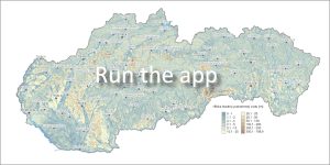
 In the years 2007 to 2011, the State Geological Institute of Dionýz Štúr (ŠGÚDŠ) implemented an extensive project Comprehensive Geological Information Base for the Needs of Nature Conservation and Landscape Management (GIB-GES). Its main goal was to create multifunctional geological and hydrogeological data of the primary landscape structure. Today, this data serves to ensure effective nature protection, support rational landscape management and landscape-ecological planning throughout Slovakia.
What does this web application contain?
The application visualizes the key results of the project and offers access to two specialized maps and databases:
-
🗺️ Map of groundwater levels under the terrain
-
🗺️ Map of groundwater flow directions
-
🗄️ Comprehensive database of engineering geological and hydrogeological boreholes
Outputs and benefits of the project
The result of expert work was the creation of a unified geoinformation database, which is based on:
-
GIS reclassification of morphological parameters and abiocomplexes (inanimate components of nature).
-
Processing of regional characteristics of morphological and geological diversity of the entire territory of the Slovak Republic.
-
Modeling of groundwater levels and flow.
All these outputs represent a fundamental basis for state nature protection, territorial planning of local governments and a comprehensive assessment of the natural conditions of our country.
📅 About the application
App launch: 12/2023
Expert Advisor:
-
RNDr. Peter Malík, PhD.
-
📞 Tel.: 02/593 75 416
-
📧 E-mail: peter.malik[at]geology.sk