



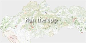
 The exploration area is legislatively defined in Section 21 of Act No. 569/2007 Coll. on Geological Works (Geological Act) as a space delimited on the surface by a closed geometric figure with straight sides without free areas. Below the surface, it is bounded by vertical planes that pass through these sides. In this area, it is permitted to carry out geological and hydrogeological exploration.
Mandatory annex to the proposal
⏱️ Legal deadline: Pursuant to § 23 par. 4 letter. e) of the Geological Act, the proposal for the allocation of an exploration area must be accompanied by a statement of the State Geological Institute of Dionýz Štúr (ŠGÚDŠ) not older than 3 months.
What is verified in the ŠGÚDŠ statement?
-
Whether the proposed PÚ does not interfere with another already designated PÚ.
-
Whether another, previously submitted proposal for designation of PÚ has not been submitted in the given area.
-
Correctness of coordinates, total area, relevant cadastre, region and presence of mineral deposits.
How to create a draft of the PÚ online?
The online application for preparing a draft of the PÚ is free of charge for every applicant and includes a brief user manual. It will allow you to quickly generate the necessary documents for your opinion.
What does the generated email package contain?
-
📄 A design in PDF format with a drawing of the entire survey area.
-
📍 Coordinates of all breakpoints.
-
📊 Percentages of affected cadastral areas and total area of the PU.
-
💾 Link to download spatial data of the area in
.shp(Shapefile) format.