




 Authors: Bodiš, D., Rapant, S. et al. | Year of publication: 1999
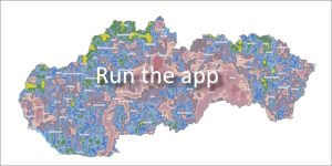
Fine-grained sediment of active river flows (streams and rivers) represents an extremely important medium from an environmental point of view in Slovakia. Given the dense river network and the rugged relief of our country, this atlas provides a comprehensive and accurate picture of the chemical state of surface water basins.
🔬 Research scope and data base
-
Time frame: Samples were taken in the years 1991 – 1995.
-
Sampling density: The statistical density reached 1 sample per 2 km².
-
Total data volume: Over 25,000 samples were analyzed, and after checking, 24,432 samples were used to create the resulting geochemical maps.
📊 Cartographic processing and visualization of elements
The distribution of chemical elements in river sediments is processed in two ways in the graphic part:
1. Area model single element maps (Grid)
This advanced model displays continuous distribution for 34 monitored elements:
Al, As, B, Ba, Be, Bi, Ca, Cd, Ce, Co, Cr, Cu, Fe, Ga, Hg, K, Li, Mg, Mn, Mo, Na, Ni, P, Pb, Rb, Sb, Se, Sn, Sr, Ti, V, Y, Zn and Zr.
2. Dot map
was used exclusively for tungsten (W). The reason is that its content was below the limit of determination of the analytical method used in more than 50% of cases. The map therefore displays the measured values directly at the sampling points.
🏛️ Access to materials
-
Online application: Interactive map layers and text attachments in PDF format.
-
Printed publication: The Geochemical Atlas of River Sediments can also be purchased in book form directly in the building of the State Geological Institute of Dionýz Štúr in Bratislava.
📂 Atlas document for download
👉 Download atlas (PDF)
📖 Citation of work:
BODIŠ, D. – RAPANT, S. et al.: Geochemical Atlas of the Slovak Republic, Part VI: River Sediments [online]. Bratislava: Dionýz Štúr State Geological Institute, 1999. Available at: https://app.geology.sk/atlasrs.
📅 About the application
Application launch: 04/2011