



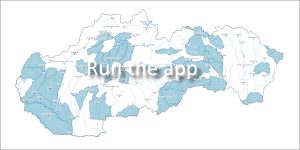
 The set of hydrogeological maps provides a comprehensive view of hydrogeological conditions, permeability of the rock environment and groundwater sources in the territory of Slovakia.
1. Hydrogeological map of the Slovak Republic at a scale of 1:200,000
This is the most detailed and comprehensive depiction of the hydrogeological conditions of the Slovak Republic at this scale, which continuously covers our entire territory.
History and development of the map
-
1971 – 1978 (Manuscript form): Processing of the first set of basic hydrogeological maps. It was the first program with a unified international methodology (IAH/UNESCO) in Slovakia.
-
1983 – 1991 (Printed edition): The maps were officially published in printed form.
-
1995 – 1998 (Digitalization): The maps were transferred to a geographic information system (GIS) as part of a project focused on research and protection of groundwater in the Western Carpathian Mountains (Malík & Švasta, 1998).
-
2006 – 2008 (International legend): Within the framework of the European project eWater (Multilingual cross-border access to ground water databases), a unified international legend (Ballofet et al., 2008; Tchistiakov et al., 2008).
The aim of the international legend: To unify the different approaches to cartographic processing in individual EU countries. It is based on the methodology of Struckmeier & Margat (1995) and respects the requirements of UNESCO/IAH (Švasta & Malík, 2008).
[🔗 Principles of compiling a hydrogeological map at a scale of 1:200,000 (PDF) ]
2. Hydrogeological maps at a scale of 1:50,000
The systematic compilation of more detailed maps at this scale dates back to the 1980s. In 1994, a methodological procedure was adopted for the creation of two-sheet maps (hydrogeological and hydrogeochemical) for the same territory, which was later confirmed in 2004 by the directives of the Ministry of the Environment of the Slovak Republic.
What does the map show?
-
Hydraulic parameters of the territory: Primarily the permeability of the rock environment and its flow capacity.
-
Geological structure: Basic properties of rocks that directly affect the movement of groundwater.
-
Point data: Exact positions of significant springs and hydrogeological wells that are key for environmental and water management assessments.
📅 About the application
Application launch: 04/2008
Last update: 01/2025
Expert Advisor:
-
RNDr. Peter Malík, PhD.
-
📞 Tel.: 02/593 75 416
-
📧 E-mail: peter.malik[at]geology.sk