



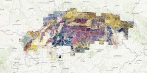
The Imperial-Royal Reich Geological Institute in Vienna began its activities on December 1, 1849. One of the first tasks was a geological survey and the compilation of a geological map of the entire territory of the Austrian Empire, after 1867 of the Austro-Hungarian Monarchy. A large number of original “field” maps on a scale of 1:28,800 have been preserved from this period, the vast majority of which are stored in the archive and library of the Austrian Geological Institute. These maps are hand-colored, folded and inserted into a cover, on which in several cases the legend and signature of the author of the map sheet are shown.
The maps are quite heterogeneous with different levels of detail. Information about tectonics and paleontology, including original author’s notes, often appears on them. The geological situation was drawn in copies of the topographic base II. military mapping of the entire territory of the then monarchy. The maps served as the basis for the compilation of a derived geological map on a scale of 1:144,000.
We sincerely thank the Austrian Geological Institute in Vienna for providing these maps from the entire territory of Slovakia.