



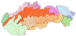
Geomorphological Division of Slovakia, Kočický, D. and Ivanič, B., 2011, scale 1 : 50,000
From 2007 to 2011, the ŠGÚDŠ, in cooperation with Esprit Banská Štiavnica, carried out a geological project “Comprehensive Geological Information Base for Nature Conservation and Landscape Management (GIB-GES).” One of the results is a refined map of the Geomorphological Division of Slovakia, which was created by revising the boundaries of the geomorphological units on the Map of Geomorphological Division at a scale of 1 : 500,000 (Mazúr and Lukniš 1986). The hierarchical classification of units was adopted from this map. The boundaries of these units were adjusted based on a digital elevation model with a resolution of 20×20 m and the morphometric characteristics derived from it, a 1:50,000 digital geological map, a digital map of abiocomplexes, a digital map of the river network, maps of horizontal and vertical relief, and satellite imagery, so as to reflect the geomorphological, geological, and tectonic conditions of the area as expressed at the appropriate scale. The units delineated in this manner were then geostatistically evaluated and characterized by summary indicators – minimum and maximum elevation, elevation range, average elevation, river network density, average slope within the geomorphological unit, and the overall ruggedness of the geomorphological unit’s relief. All characteristics are part of a digital spatial database.