



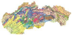
Tectonic Map of the Slovak Republic, Bezák, V. et al., 2004, scale 1 : 500,000
The majority of the Western Carpathian mountain range lies within the territory of the Slovak Republic. This mountain range has undergone a long-term and complex tectonic evolution. In the tectonic map of the Slovak Republic, the team of authors presents their current view of the tectonic structure of the Western Carpathians. The map and its legend are organized according to the stages of the tectonic evolution of the Western Carpathians. The 1:500,000 – scale tectonic map of Slovakia is based primarily on the latest 1:500,000 – scale geological base maps (Biely et al., 1996; Lexa et al., 2000) and supplements data from regional geological maps at a scale of 1:50,000. The most recent tectonic maps at these scales were the Tectonic Map of Czechoslovakia at a scale of 1:500,000 (Maheľ et al., 1984) and the Tectonic Map of Czechoslovakia at a scale of 1:1,000,000 (Biely et al., 1968).
Tectonic Evolution of the Western Carpathians and the Structure of the Tectonic Map (PDF)